August 17, 2022
Briefing The Geography Of Vietnam
TipsVietnam is a country located on the eastern edge of the Indochinese peninsula, where it borders the East Sea and is considered the center of Southeast Asia.
Viewed from the world map, it can be seen that Vietnam has an S-shaped land strip extending from latitude 23°23' north to 8°27' north, 1,650 km long in the north-south direction. Stretching over about 15 latitudes, bringing differences in climate characteristics between regions in the country. The widest part on the mainland is about 500km; the narrowest place is nearly 50km.
With a total land area of 331,212 km² and the waters under the sovereignty, sovereign rights and jurisdiction of Vietnam occupy an area of about 1,000,000 km of the East Sea. Vietnam's land border is 4,639 km long, bordering China in the north, Laos and Cambodia in the west, and the Gulf of Thailand in the southwest.
Vietnam is located in the intertropical zone of the Northern Hemisphere, near the center of Southeast Asia, considered a bridge position between the mainland and the sea, because it borders on the mainland to the west and borders to the east. The sea is located at the contact point of monsoons and biomes, so it has a humid tropical monsoon climate and diverse organisms.
The following article will focus on 3 main issues of Vietnam's geography, namely provinces, climate and environmental problems. Let's find out together!
- 1. Provinces of Vietnam
According to the census results on April 1, 2019 of the General Statistics Office, the population of Vietnam is 96,208,984 people. The most populous province is Ho Chi Minh City with 8,993,083 people, ranked second is Hanoi capital with a population of 8,053,663 people, followed by Thanh Hoa with 3,640,128 people, Nghe An with 3,327 people. ,791 people, and Dong Nai 3,097,107 people. The province with the least population is Bac Kan with 313,905 people, followed by Lai Chau and Kon Tum provinces. By area, the largest province is Nghe An. The smallest province is Bac Ninh province.
Vietnam is organized into 58 provinces and 5 municipalities that are on the same level as provinces.The provinces are split into districts, provincial cities, and county-level towns, which are further divided into commune-level towns or communes.
The municipalities are split into urban and rural districts, each of which is further divided into wards.
A People's Council that is chosen by the populace governs the provinces of Vietnam. A People's Committee, which serves as the executive branch of the province government, is chosen by the People's Council. This arrangement is a condensed representation of how the national government of Vietnam operates. The central government is anticipated to be in charge of the provinces.
The largest province in terms of land size is Nghe An, which extends from the city of Vinh up the huge Song Ca valley. Bac Ninh, which is in the populated Red River Delta, is the smallest. Here is a table that shows the population and size of each province in Vietnam as of April 1, 2009.
| No. | Province/City | Region |
| 1 | An Giang | Mekong Delta |
| 2 | Bà Rịa - Vũng Tàu | Southeast |
| 3 | Bạc Liêu | Mekong Delta |
| 4 | Bắc Giang | Northeast |
| 5 | Bắc Kạn | Northeast |
| 6 | Bắc Ninh | Red River Delta |
| 7 | Bến Tre | Mekong Delta |
| 8 | Bình Dương | Southeast |
| 9 | Bình Định | South Central Coast |
| 10 | Bình Phước | Southeast |
| 11 | Bình Thuận | South Central Coast |
| 12 | Cà Mau | Mekong Delta |
| 13 | Cao Bằng | Northeast |
| 14 | Cần Thơ | Mekong Delta |
| 15 | Đà Nẵng | South Central Coast |
| 16 | Đắk Lắk | Central Highlands |
| 17 | Đắk Nông | Central Highlands |
| 18 | Điện Biên | Northwest |
| 19 | Đồng Nai | Southeast |
| 20 | Đồng Tháp | Mekong Delta |
| 21 | Gia Lai | Central Highlands |
| 22 | Hà Giang | Northeast |
| 23 | Hà Nam | Red River Delta |
| 24 | Hà Nội | Red River Delta |
| 25 | Hà Tĩnh | North Central |
| 26 | Hải Dương | Red River Delta |
| 27 | Hải Phòng | Red River Delta |
| 28 | Hậu Giang | Mekong Delta |
| 29 | Hoà Bình | Northwest |
| 30 | Thành phố Hồ Chí Minh | Southeast |
| 31 | Hưng Yên | Red River Delta |
| 32 | Khánh Hoà | South Central Coast |
| 33 | Kiên Giang | Mekong Delta |
| 34 | Kon Tum | Central Highlands |
| 35 | Lai Châu | Northwest |
| 36 | Lạng Sơn | Northeast |
| 37 | Lào Cai | Northwest |
| 38 | Lâm Đồng | Central Highlands |
| 39 | Long An | Mekong Delta |
| 40 | Nam Định | Red River Delta |
| 41 | Nghệ An | North Central |
| 42 | Ninh Bình | Red River Delta |
| 43 | Ninh Thuận | South Central Coast |
| 44 | Phú Thọ | Northeast |
| 45 | Phú Yên | South Central Coast |
| 46 | Quảng Bình | North Central |
| 47 | Quảng Nam | South Central Coast |
| 48 | Quảng Ngãi | South Central Coast |
| 49 | Quảng Trị | North Central |
| 50 | Quảng Ninh | Northeast |
| 51 | Sóc Trăng | Mekong Delta |
| 52 | Sơn La | Northwest |
| 53 | Tây Ninh | Southeast |
| 54 | Thái Bình | Red River Delta |
| 55 | Thái Nguyên | Northeast |
| 56 | Thanh Hoá | North Central |
| 57 | Thừa Thiên Huế | North Central |
| 58 | Tiền Giang | Mekong Delta |
| 59 | Trà Vinh | Mekong Delta |
| 60 | Tuyên Quang | Northeast |
| 61 | Vĩnh Long | Mekong Delta |
| 62 | Vĩnh Phúc | Red River Delta |
| 63 | Yên Bái | Northwest |
- 2. Climate of Vietnam
a. The overview of climate of Vietnam
Vietnam is located in a tropical climate and has a tropical monsoon climate with abundant sunshine, abundant rainfall and high humidity. Some places near the Tropic of Cancer or high mountains have a temperate climate.

The average annual temperature is from 22°C to 27°C, very suitable for tourists. However, the average temperature in each place is different, Hanoi 23 degrees C, Ho Chi Minh City 26°C, Hue 25°C.
Vietnam lies entirely in the tropics and the southeast edge of mainland Asia, bordering the East Sea. Therefore, it should be directly affected by the commercial monsoon climate, which often blows in low latitudes. That shows typical weather and climate characteristics.
The tropical monsoon climate is characterized by seasonal rainfall and monsoon. In which, it is divided into two distinct seasons: the dry season (from November to April next year) and the hot rainy season (from May to October).
Vietnam can be divided into two regions with two major climate zones: the North is a tropical monsoon climate, with 4 distinct seasons (Spring - Summer - Autumn - Winter), influenced by the Northeast monsoon (from the Asian continent) and the Southeast monsoon (blows through Thailand - Laos and the East Sea), with high humidity. Because the South is less affected by the monsoon, the tropical climate is quite moderate, hot all year round and divided into two distinct seasons (dry season and rainy season).
Besides, due to the structure of the topography, Vietnam also has sub-climate regions. There are places with temperate climate such as in Sa Pa, Lao Cai province; Da Lat, Lam Dong province; Some places belong to continental climate such as Lai Chau, Son La. These are ideal places for travel and vacation.
There is sunshine, abundant rainfall and high humidity. Our climate is considered to be relatively ideal. By the fact that it is not too cold or too hot like some other areas of the world. However, it still brings characteristics from time to time and from region to region.
b. Climate Zone in Vietnam
Vietnam has four main climate zones, including: Northern climate zone, Southern climate zone, Truong Son climate zone, and East Sea climate zone.
- The Northern Climate zone
Including the territory north of the Lam River. This region has a humid subtropical climate. However, this climate is characterized by instability with the start and end times of the seasons and in terms of temperature.
The Northeast region includes the Northern Delta and the hilly areas on the left bank of the Red River. This region has a common topographical feature of low hills below 1000m. The arc-shaped mountain ranges to the Northeast are clustered towards the Tam Dao mountain range. Those are the arcs of Dong Trieu, Bac Son, Ngan Son, and Song Gam that do not prevent but form the slopes leading to the northeast monsoon and the north wind often blows in winter. This area is adjacent to the Gulf of Tonkin to the East, the West is blocked by the highest Hoang Lien Son range in Vietnam, so it is affected by the humid monsoon climate more than the Northwest region. Therefore, the Northeast region is directly affected by tropical storms, in summer, less affected by Lao wind (foehn wind).
Northeast, the difference can be up to 2-3°C if compared with the same altitude. In mountainous areas, the direction and location of an area in a mountain range plays an important role in the heat-humidity regime. In general, in terms of midland and mountainous areas, the study of climate is very important because the variation of climate occurs in small areas. Climate events in mountainous areas are extreme in nature, especially in the condition that the forest cover is reduced and the soil cover is degraded. Heavy rain combined with some conditions causes flash floods; drought in the dry season often occurs but sometimes the drought lasts beyond the tolerance of the flora.
- Truong Son climate zone
Consists of the eastern part of the Truong Son range, extending from the south of the Lam River to Mui Dinh. This region is characterized by a tropical monsoon climate. This region can be divided into two regions:
+ Northern region of Hai Van pass: has shorter winter days than northern climate and summer is strongly influenced by wind blowing from Laos to Central Vietnam. In winter, this region is still affected by cold weather brought by the northeast monsoon and often accompanied by heavy rain (the area with a lot of rain due to the northeast monsoon is from Ha Tinh to Thua Thien Hue) due to winds from The northeast brings in steam from the sea. In the summer, due to the absence of water vapor, the southwest wind causes hot and dry weather, this wind is called foehn wind.
+ South Central Coast: (from Da Nang to Ninh Thuan) is the coastal plain of South Central Coast south of Hai Van pass similar to the north of Hai Van pass. However, with higher temperatures and occasional cold spells in winter, although not for long, the influence of the hot dry west wind is not as great as in the North Central region and the dry season lasts longer. Particularly in the rainy season, the area from Da Nang to Quang Ngai is similar to the North Central region. Starting from the south of Khanh Hoa, Ninh Thuan, and Binh Thuan, the rainfall is very low, usually only 700-1300mm.
An important feature of this climate region is that the rainy and dry seasons do not coincide with the rainy and dry seasons of the other two climates. Summer, while the whole country has the heaviest rainfall, this climate region is in the driest period.
- Southern Climate zone
Including the territory of the Central Highlands and the South. This region has a tropical savanna climate with two seasons: the dry season and the rainy season (from April-May to October-November). All year round, the temperature of this region is high, the temperature range is significantly smaller than the North Bach Ma area. It has a long, exceptionally deep dry season. The climate in this region is less volatile during the year.
- East Sea Climate zone
The East Sea of Vietnam has tropical characteristics of the ocean season and is relatively homogeneous. There are often tornadoes coming from the Pacific Ocean, forming big storms. Due to being in the Northern Hemisphere, storms and tropical depressions entering Vietnam swirl counter-clockwise.
c. Climate Change
Vietnam will be among the countries most affected by global climate change. A large number of studies show that Vietnam is experiencing climate change and will be severely negatively affected in the coming decades. These negative impacts include sea level rise, saline intrusion and other hydrological problems such as floods, estuary changes, sedimentation, as well as increased frequency of natural disasters such as cold waves, regular high tides. will cause negative effects on the development and economy of the country including agriculture, aquaculture, road infrastructure, etc.
Some problems such as land subsidence (due to over-exploitation of groundwater) exacerbate some of the impacts that climate change will bring (sea level rise), especially in areas such as the Mekong Delta. Kowloon. Governments, NGOs and citizens have taken various measures to mitigate and adapt to the impact.
- 3. Environmental problem in vietnam
- The risk of deforestation and forest resources.
In fact, deforestation has made resources increasingly depleted, and occurs in many areas at the same time. Deforestation is considered a national disaster.
In recent years, the area of natural forests in Vietnam has been declining rapidly, and the quality of forests has deteriorated heavily. In the period from 2011 to now, the total damaged forest area is estimated at more than 22,800 ha, of which the forest area burned is about 13,700 ha, the rest is due to illegal cutting. On average, Vietnam loses about 2,500 hectares of forest each year.
- Rapid deterioration of soil quality and arable land.
Desertification and land degradation are problems of global scale, having great and serious impacts on sustainable development, ecological safety, social security and food security. Vietnam is also one of the areas affected by this disaster.
Today's desertification is widespread not only in dry areas but also in wet and rainy areas, due to the unreasonable use of land resources.
- Marine resources, especially coastal marine resources, have been significantly reduced.
According to the State of the National Sea and Island Environment Report for the period 2016-2020, marine resources are being over-exploited and unsustainable. It is estimated that seagrass in the whole sea area of our country from Quang Ninh to Ha Tien has lost about 40 - 60%; Mangrove forests lost up to 70% and about 11% of coral reefs were completely destroyed, unable to restore themselves.
The primary mangrove forests are almost lost. The severe decline in mangrove areas has led to the decline of marine biodiversity, especially the loss of breeding grounds and habitats of aquatic species.
Notably, the seagrass bed ecosystem is one of the important marine ecosystems, but is currently facing the risk of injury and degradation.
Besides, over the past 20 years, Vietnam has lost 12% of its coral reefs; Another 48% of coral reefs are in serious deterioration. The area of lost coral reefs is concentrated mainly in inhabited areas such as Ha Long Bay, the central coastal provinces and some inhabited islands where the coverage is reduced by over 30%. The loss of area and damage of many coral reefs reduces biodiversity, ecology and marine environmental quality; damage to tourism, fisheries and livelihoods of coastal communities.
- Mineral resources, water resources, biological resources, ecosystems, etc., inappropriate use.
Due to the lack of synchronous management, outdated mining technology, especially the unreasonable exploitation and use of many groups of resources, etc., are the causes leading to the waste of national resources and the loss of resources. degradation, depletion, threatening the country's sustainable development.
Accordingly, rare and precious species are facing a very high risk of extinction. In Vietnam, there are about 100 species of plants and nearly 100 species of animals in danger of extinction.
Besides, mineral resources are gradually depleted after over-exploitation and wasteful use. Land resources are also facing many difficulties such as agricultural land is gradually being converted to land for industry and services, soil is saline, increasing desertification, etc.
- Environmental pollution: water, soil and air are serious.
The situation of environmental pollution continues to be complicated, with many hot spots, and the quality of the environment in many places has declined sharply. Worryingly, environmental incidents continue to increase in severity, many of which have wide-ranging impacts, complicated developments, and make it difficult for management and remedial work. Many complex environmental sanitation problems have arisen in urban and rural areas.
On the other hand, currently, the air quality in urban areas, especially big cities such as Hanoi and Ho Chi Minh City, tends to decrease and become increasingly serious. With the increase in air pollution sources, the air quality exceeds the allowable threshold, which has greatly affected people's lives and health. Meanwhile, domestic solid waste has not been classified at source; Landfill rate accounts for more than 70%, mainly unsanitary; still nearly 36.5% of domestic waste in rural areas has not been collected, treated, etc.
- The effects of war, especially toxic chemicals.
The war has passed, but its consequences are extremely serious for the natural environment and Vietnamese people.
About 86% of the poison was sprayed over densely forested areas; The remaining 14% is used to destroy fields and crops, mainly rice fields and shifting cultivation in mountainous areas. The area of mangroves affected by toxic chemicals is 150,000 ha, typically the mangrove forest in Ca Mau.
With a huge amount of toxic chemicals sprayed repeatedly over a long period of time, the environment is heavily polluted, ecosystems are turned upside down, many species of plants and animals are destroyed. Due to the severe destruction of forests, the environmental protection function of the watershed protection forests of 28 river basins was also broken, causing great damage to the economy.
- Population growth is too fast
The unequal and unequal distribution of the labor force between regions and resource extraction sectors are the most complex problems in population and environmental relations.
- Limited physical and technical facilities.
While the demand for rational use of resources is constantly increasing, the requirements for environmental improvement and anti-pollution are increasingly large and complex, the system of physical - technical facilities, officials and laws. There are many limitations and inadequacies in the solution to environmental problems.
- 4. Terrain of Vietnam
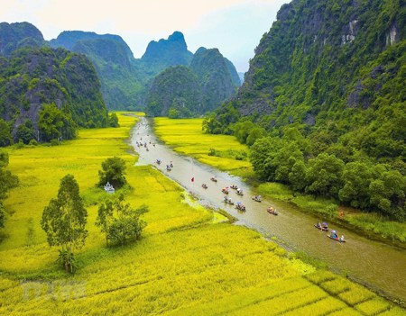
Vietnam's predominant terrain types include hills and mountains, plains, coastlines, and the continental shelf due to its tropical climate, which is hot, humid, and frequently accompanied by monsoon winds. There are no dry or cold deserts in Vietnam; there are only deserts made of sand. Additionally, Vietnam's terrain descends from the northwest to the southeast, which is represented in the flow of the country's main rivers.
Up to 75% of Vietnam territory is mountains and hills. But typically, they are low: Over 2,000 m high mountains barely make up 1% of all mountains in Vietnam, whereas low mountains under 1,000 m make up a whopping 85% of the country. From the northwest to the southeast, with a distance of 1400 km, Vietnam is covered in mountains and hills, which take the form of a massive arch toward the South China Sea. Mount Fansipan - the tallest mountain in the entire Indochina area at 3,143 meters, is one of the most majestic mountains in the world, located in the west and northwest (Vietnam, Laos, Cambodia). As they move eastward in Vietnam, mountains often grow more slowly and end up as low ground along the ocean. Central Highlands, a region in southern Vietnam, is characterized by vast expanses of typical highlands with a few prominent peaks, as opposed to the lengthy, high mountain ranges seen in the north (or Central Highlands). The Truong Son Mountains, the most famous mountains in Vietnam because of their significance in the Vietnam War, were lifted from Central Highlands's eastern side as a result of natural processes.
Only 25% of Vietnam's land is made up of plains, which are further split into several zones by mountains and hills. North Delta (or Red River Delta; 16,700 square kilometers; located around Red River) and South Delta are the two broadest and most productive plains in the nation (or Mekong Delta , 40,000 square kilometers , around Mekong River downstream). These two plains are separated by the Coastal Plains, a string of sporadic tiny plains that stretches across the central coast from Ma River in Thanh Hoa province to Phan Thiet city in Binh Thuan province and covers a total size of 15,000 square kilometers.
Finally, without mentioning Vietnam's wide variety of rivers, any discussion of its topography would be lacking. Incredibly, Vietnam has 2,360 rivers longer than 10 kilometers. In Vietnam, there are two primary river flow directions: northwest-southeast rivers and arch rivers. The Red River in the north and the Mekong River in the south are the two largest rivers, as was already noted. Vietnam's complete network of rivers and streams receives up to 310 billion cubic meters of water annually, and there are two seasons for river flow: flood season and dry season, with the flood season accounting for 70 to 80 percent of the total quantity and frequently causing flooding in neighboring towns.
- 5. Land types, fauna and flora of Vietnam
Despite the wide variety of land types in Vietnam, most of them are fertile and conducive to the growth of agriculture and fisheries. Due to Vietnam's favorable geology and temperature, the nation boasts a diverse vegetation with up to 14,600 plant species. Vietnam's flora, which is predominantly made up of plants that prefer high temperatures, high humidity, and sunlight, resides primarily in tropical woods.
Vietnam has a diverse range of wildlife, including 275 species of mammals, 800 species of birds, 180 species of reptiles, 80 species of amphibians, 2,400 kinds of fish, and 5,000 types of insects. Several of these animal species are included on the IUCN Red List of Threatened Species. Asian black bears, sun bears, foxes, and civets are often found in the Northern Highlands and mountains, while many different species of monkeys—including the red-shanked douc—and wild cats are found in deep woods.
Vietnam has set up several natural reserves and national parks throughout the whole nation to protect and develop its biodiversity. The most notable names are Bach Ma (Thua Thien Hue province), Con Dao (Ba Ria Vung Tau province), Cat Tien (Dong Nai province), Hoang Lien Son (around Fansipan Mount, Lao Cai province), Cuc Phuong (Ning Binh province), Phong Nha Ke Bang (Quang Binh province), and Hoang Lien Son (around Fansipan Mount, Lao Cai province). Additionally to being attractive tourist destinations, they are also where Vietnamese and foreign biologists perform their research.
Categories
What To Know Before Travel in Vietnam
October 20, 2022

What To Know About Vietnam Tax?
October 18, 2022

Laws In Vietnam: Expats Need To Know
October 18, 2022
Enter your email address to receive good tips about foreigner community